Delaware
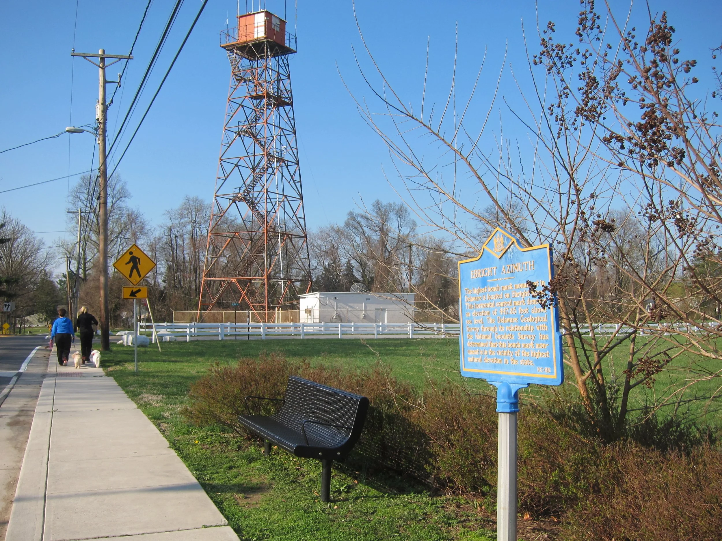
#9 Ebright Azimuth, elevation 448 ft.
Sidewalks. Microwave radio. Japanese music.
Ebright Azimuth, second-lowest highpoint in the nation, has a an appealing bench.
Driving south on I-95, the most logical route to Ebright takes you across not the dreaded Delaware Memorial Bridge but the Commodore Barry, which I'd never heard of. But my GPS had.
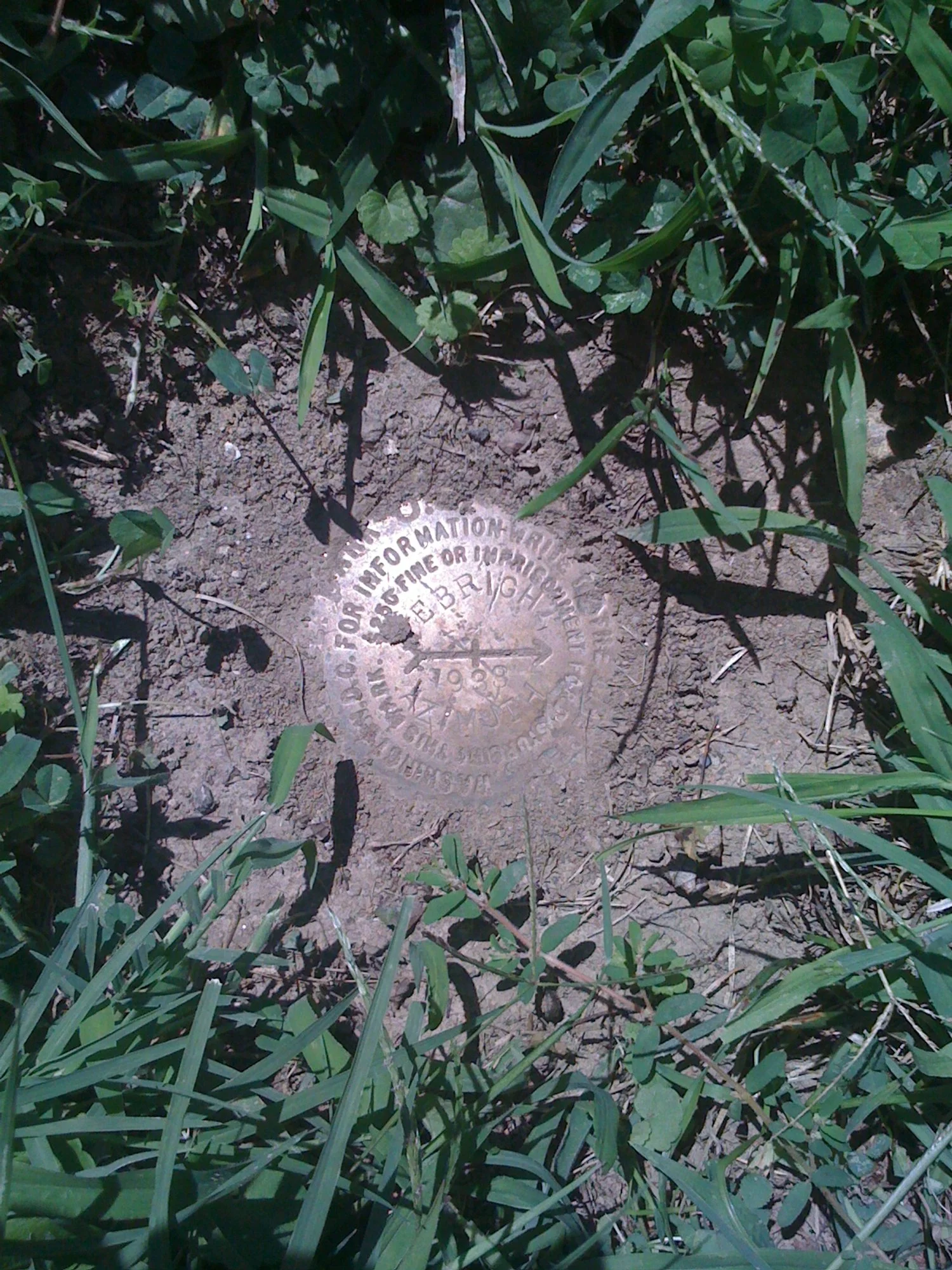
The USGS benchmark takes some sleuthing to find. The key is to walk down the sidewalk toward the rusty radio tower, keeping an eye on the ground for a crescent-shaped cutout in the pavement. Nestled in the concavity is the benchmark. I have two pictures of it in the slideshow: one from spring (mud, faded flowers) and one from late summer (encroaching crabgrass).
I've been to Ebright twice, each time on a road trip to visit family in Virginia. On the most recent trip I shot a video in which you'll hear me speak. The music is from a compilation of songs played on the koto, a Japanese variant of the zither. I’m not sure where the Japanese theme came from. In the final days of World War II, the Japanese people first heard the voice of their god-emperor, Hirohito, on the radio as he gravely intoned the surrender of the imperial armies. The Met has a koto in the shape of a hawk:
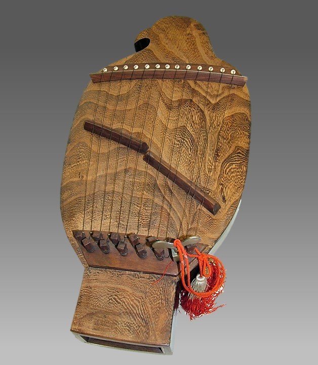
Asano Tōshichi (Japanese, late 19th century). Paulownia wood and metal strings, H. 20 in. The Crosby Brown Collection of Musical Instruments, 1889 (89.4.1549)
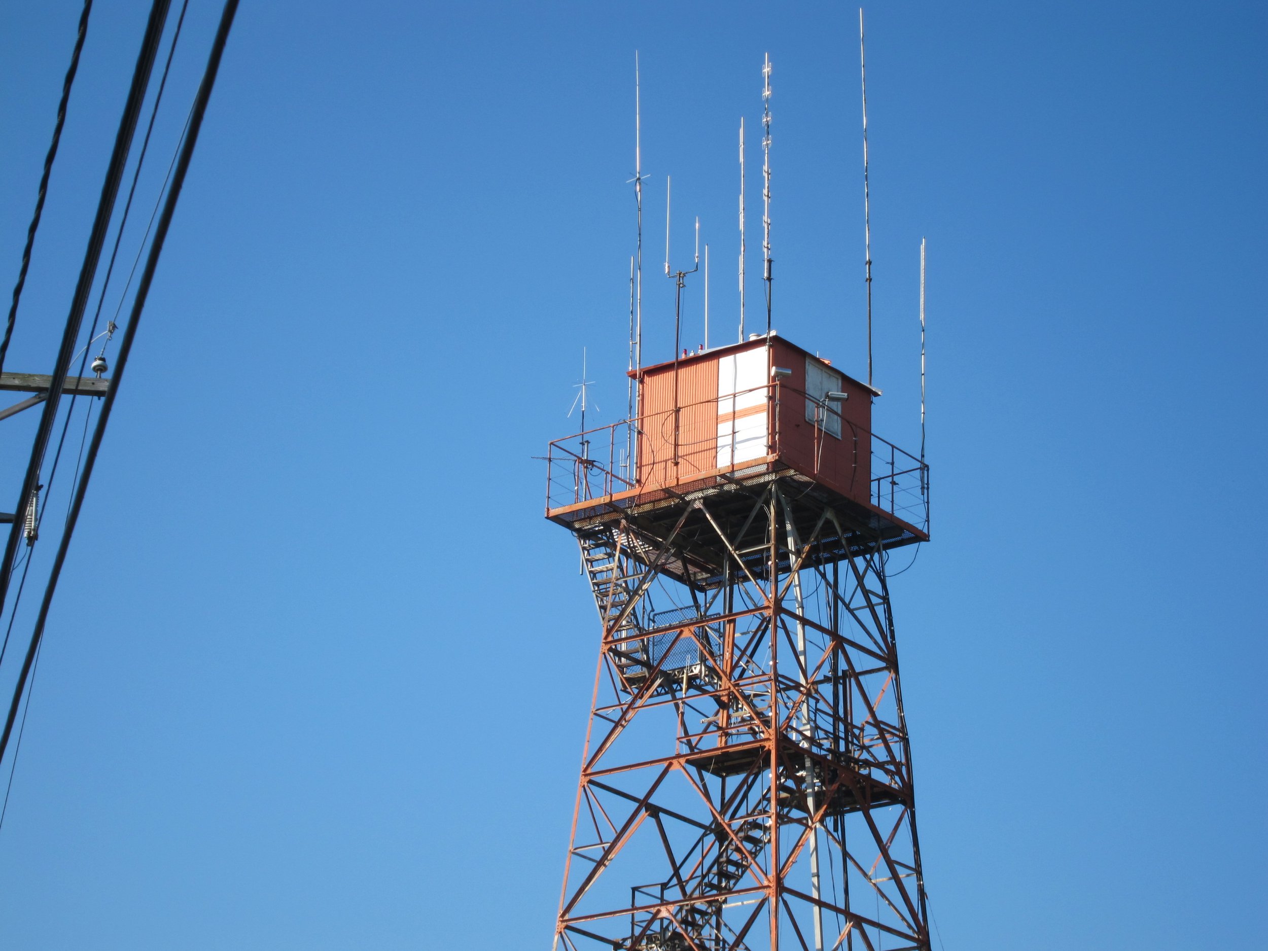
The history of the radio tower is interesting. Here is what Wiki has to say:
The self-supporting radio tower just south of the benchmark was constructed in 1947 by Western Union as part of a historic C-band microwave radio relay system that linked New York City and Washington, D.C. This site was assigned the name "Brandywine" in recognition of Brandywine Creek located several kilometers to the west and was licensed with the call sign KGB29. Western Union's engineers specified a heavy-duty prefabricated fire tower structure, which allowed the microwave transmitters and receivers to be installed inside the cab.
Wiki also gives the origin of the site’s name (“Ebright Azimuth is named after James and Grant Ebright, who owned the property on which the benchmark was placed) and repeats the (contentious to some) observation that the true height of land is in the nearby mobile home park, and it offers several increasingly obtuse definitions of an azimuth:
An azimuth (/ˈæzəməθ/ ; from Arabic: اَلسُّمُوت, romanized: as-sumūt, lit. 'the directions') is the angular measurement in a spherical coordinate system which represents the horizontal angle from a cardinal direction, most commonly north.
Mathematically, the relative position vector from an observer (origin) to a point of interest is projected perpendicularly onto a reference plane (the horizontal plane); the angle between the projected vector and a reference vector on the reference plane is called the azimuth.
When used as a celestial coordinate, the azimuth is the horizontal direction of a star or other astronomical object in the sky. The star is the point of interest, the reference plane is the local area (e.g. a circular area with a 5 km radius at sea level) around an observer on Earth's surface, and the reference vector points to true north. The azimuth is the angle between the north vector and the star's vector on the horizontal plane.
Azimuth is usually measured in degrees (°), in the positive range 0° to 360° or in the signed range -180° to +180°. The concept is used in navigation, astronomy, engineering, mapping, mining, and ballistics.
The word “azimuth,” Wiki shares, is Arabic in origin and perhaps first used in English by Chaucer in his Treatise on the Astrolabe (1391). In the Museum’s collection is an Iranian astrolabe from the seventeenth century that is about the same general shape as the Ebright marker. “Astrolabes of this size,” the online entry reads, “were not precise enough for astronomical observations, but served well for telling time, and astrologers could use them to determine the position of a planet relative to the different astrological houses.”
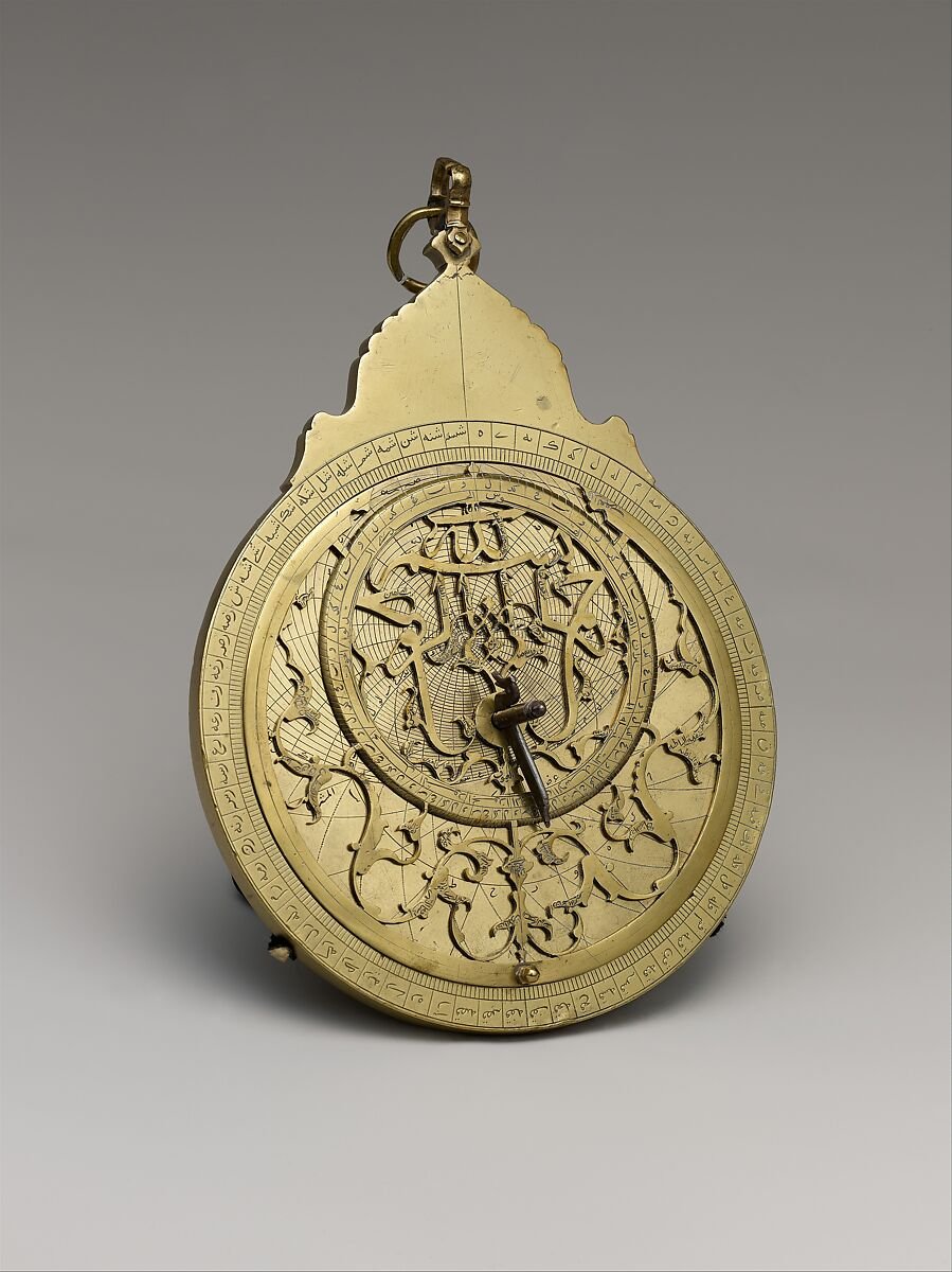
Muhammad Zaman al-Munajjim al-Asturlabi (Iranian, active 1643–1689), dated 1065 AH/1654–55 CE. Brass and steel, H. 8 1/2 in. (21.6 cm). Harris Brisbane Dick Fund, 1963 (63.166a–j)
Ebright Azimuth
The radio tower does house UHF equipment, but it was built as part of a historic microwave relay system between New York and Washington, D.C. The Japanese them music is explained above.